Hmmm. We’ve had heavy downpours with lightening and thunder, frequently overcast skies, and chilly temperatures. I think the rainy season may be creeping up on us in Kisoro. In fact, most of this summer has felt more “rainy season” than not, and I’m often cold. Sometimes I wonder if I’m really near the equator.
The other day, Tyler and I tried to go for a walk, and got d…r…e…n…c…h…e…d. I learned my “H2No” jacket is more “H2Hello” when it rains that hard. We ended up jogging part of the way home because the lightening and thunder flashing and cracking all around us felt a little too close for comfort.
Now, my sandals, labeled “waterproof” because they’re designed to dry quickly after getting wet, feel oh-so-cold and clammy on my feet, not drying out despite my feet being in them for hours now (which usually does the trick). And, as I mentioned before, weather like this makes me think about laundry (I never knew clean clothes meant so much to me!). In this sort of weather, we need to leave ours out on the lines under the porch for a few days before it’s suitably dry, and I’ve noticed the faint smell of mildew on my fleece jacket (ew).
Yahoo.
But I know I shouldn’t complain. At least we have a porch to hang our laundry under when it rains…right?
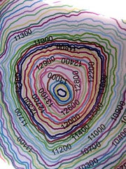
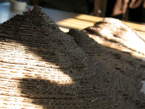
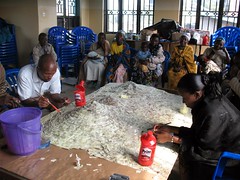
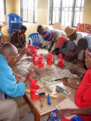
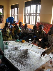
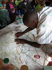
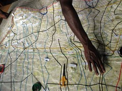
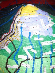
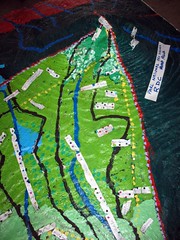
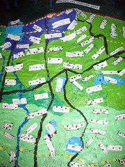
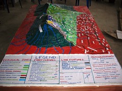
Moisture and mildew aside, the Batwa recently completed the Mgahinga Gorilla National Forest. Seven communities helped create the map (helping build it, and fill in the information). The final product looks amazing!
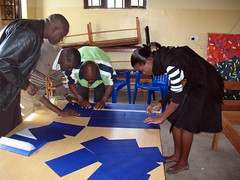
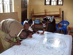
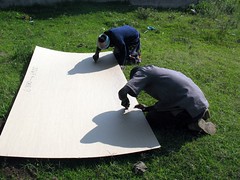
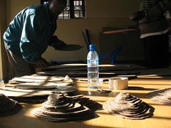
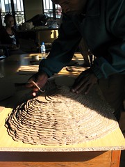
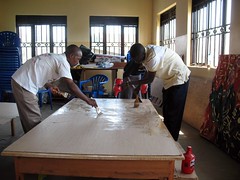
Below are photos showing the map’s progression:
A large topo map with color-coded contour lines is made; carbon paper is taped together to fit the size of the map; the contour lines are traced onto many different pieces of cardboard; the contours are cut out of the cardboard.
The pieces are glued and stacked; the completed map is basted in crepe paper squares to soften the contour lines; the Batwa give their information (discuss, agree, disagree, confirm); rough draft string and pins, marking different features of the forest, are placed.
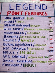
When all are in agreement, the map is painted with the details (boundaries, roads, rivers, etc.), pins and paper labels marking different communities and resources are placed, and a legend is created. (Whew!).
Some fun facts about the volcanoes: there are five total, I think, but we can only see three from Kisoro. The tallest is Muhuvura, next to it is the smallest called Gahinga, and then there’s Sabinyo, which as weird lumps on top of it. I’ve learned “Muhuvura” means something like “the compass/guide;” Gahinga is named after the small piles of rocks farmers create in their fields as they dig up the soil (Gahinga looking like a cute “little” mound); and Sabinyo means something like “crazy teeth,” as its lumps look like…you guessed it…crooked crazy teeth.
Posted By Dina Buck
Posted Aug 19th, 2011


247 Comments
http://quotes.myfreeip.me/sitemap.xml
July 20, 2016
That’s a smart answer to a difficult question.
http://www./
October 23, 2016
I’m impressed! You’ve managed the almost impossible.
http://www./
November 3, 2016
I am still puzzled: if the text of the law is clear, can the administration take a deviating position by means of some creative interpretation? I would believe that applicants are well advised to file any divisional applications within 2 years from the Rule 161 Communication.
http://www./
November 26, 2016
OMG I'm totally SWOONING over Fridays faaaaabulous frock(gorgeous!)and watch pendant(the only way to wear a watch!) and I'm goggling over your goodies and your body on this post!ARGH! Rather eye opening for this gals early morning at work!! JEEZ but you have THE hottest body!! Would love to feel you up,missus!!! Jealous as all hell of the suitcase,mags,bod,Jon's adorable hat,love the new miseables……..love it all,really!!LOVE YOU!!!Skype ya later!Helga xxxXXXxxx